File:Oslo Cirkus modern map.png
From Circopedia
Size of this preview: 441 × 600 pixels. Other resolution: 176 × 240 pixels.
Original file (1,103 × 1,500 pixels, file size: 2.28 MB, MIME type: image/png)
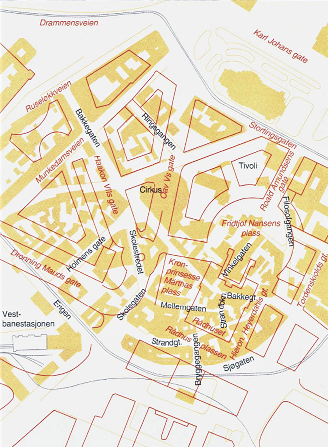
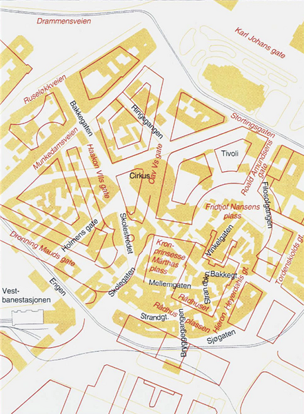
Map of Vika neighborhood in Oslo showing the newly built area (outlined in red) over the old neighborhood (in yellow) with the location of the Cirkus Verdensteater on today's Olav V Gate.
See Also
- History: Cirkus Verdensteater (Oslo)
File history
Click on a date/time to view the file as it appeared at that time.
| Date/Time | Thumbnail | Dimensions | User | Comment | |
|---|---|---|---|---|---|
| current | 21:00, 29 June 2025 | | 1,103 × 1,500 (2.28 MB) | Djando (Talk | contribs) | Map of Vika neighborhood in Oslo showing the newly built area (outlined in red) over the old neighborhood (in yellow) with the location of the Cirkus Verdensteater. |
- You cannot overwrite this file.
File usage
The following page links to this file: