File:Map of circus in Frankfurt.png
From Circopedia
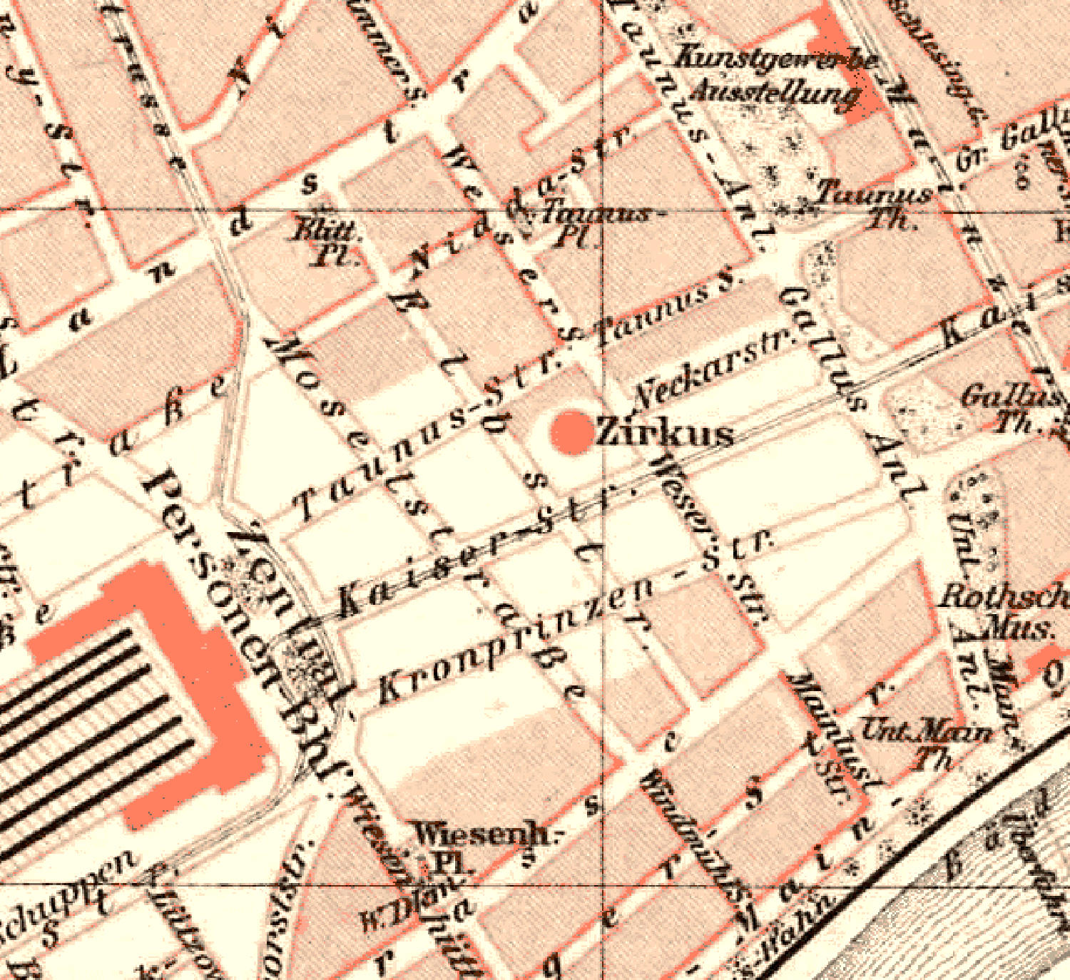
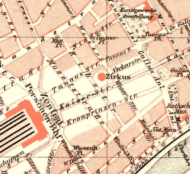
Revision as of 02:14, 5 July 2012 by Djando (Talk | contribs) (1893 map of Frankfurt am Main, Germany, showing the first Circus Schumann construction near the train station in 1893 (detail). From ''Meyers Konversations-Lexikon'', 5th edition (1893-1897))
Size of this preview: 655 × 600 pixels. Other resolution: 262 × 240 pixels.
Original file (1,500 × 1,374 pixels, file size: 187 KB, MIME type: image/png)
1893 map of Frankfurt am Main, Germany, showing the first Circus Schumann construction(French) A temporary circus building, originally made of wood and canvas, and later, of steel elements supporting a canvas top and wooden wall. Also known as a "semi-construction." near the train station in 1893 (detail). From Meyers Konversations-Lexikon, 5th edition (1893-1897)
File history
Click on a date/time to view the file as it appeared at that time.
| Date/Time | Thumbnail | Dimensions | User | Comment | |
|---|---|---|---|---|---|
| current | 02:14, 5 July 2012 | | 1,500 × 1,374 (187 KB) | Djando (Talk | contribs) | 1893 map of Frankfurt am Main, Germany, showing the first Circus Schumann construction near the train station in 1893 (detail). From ''Meyers Konversations-Lexikon'', 5th edition (1893-1897) |
- You cannot overwrite this file.
File usage
The following page links to this file: