File:Cirque de l'Impératrice - 1869 map.jpg
From Circopedia
Size of this preview: 726 × 600 pixels. Other resolution: 291 × 240 pixels.
Original file (1,500 × 1,239 pixels, file size: 655 KB, MIME type: image/jpeg)
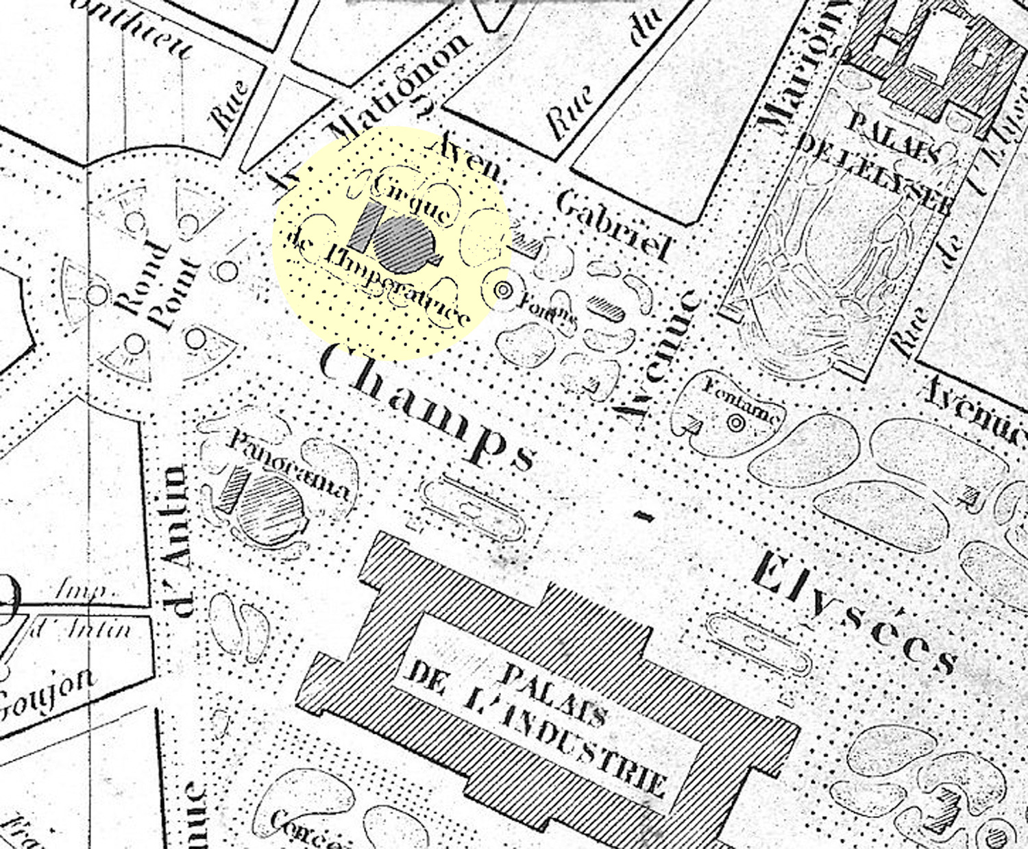
The Cirque de l'Impératrice (highlited in yellow) on an 1869 map of Paris. The "Avenue d'Antin" (on the left) is today's "Avenue Franklin D. Roosevelt." The Panorama (at the corner of the Avenue d'Antin and the Champs-Élysées) is still extent, and is now the Théâtre du Rond-Point; it was the identical architectural pendant of the Cirque des Champs-Élysées, and it outside architecture is similar to that of the circus. The Palais de l'Industrie (bottom right) has been destroyed in 1897 to make room for the present Grand Palais. — Document: University ofChicago
See Also
- Circuses: Cirque des Champs-Élysées
File history
Click on a date/time to view the file as it appeared at that time.
| Date/Time | Thumbnail | Dimensions | User | Comment | |
|---|---|---|---|---|---|
| current | 23:11, 10 April 2014 | | 1,500 × 1,239 (655 KB) | Djando (Talk | contribs) |
- You cannot overwrite this file.
File usage
The following page links to this file: